Harpers Ferry, WV, is a hiker’s paradise. It offers a range of hiking trails that showcase the region’s rich history, stunning landscapes, and diverse ecosystems. Whether you’re looking for a challenging ascent with rewarding views or a leisurely walk along a historic canal, there’s a trail for everyone. Here are some of the best hikes in the Harpers Ferry, WV area, complete with mileage and parking information. River & Trail Outfitters offer Harpers Ferry hiking shuttles in and around the Harpers Ferry area.
Favorite Hikes in the Harpers Ferry Area
| Hikes | Hike Distance | Difficulty | Location | Distance from River & Trail Harpers Ferry Location |
|---|---|---|---|---|
| C&O Canal Towpath | Varies, the towpath runs 184 miles | Easy | Many access points; we recommend parking in Harpers Ferry or Brunswick, MD to access the towpath | 3 miles if accessing the towpath from Harpers Ferry, 12 miles if accessing from Brunswick, MD |
| Sweet Run State Park | Up to 9 miles of trails | Easy to Moderate | Hillsboro, VA | 8 miles |
| Weverton Cliffs | 2.7 miles | Moderate | Knoxville, MD | 8 miles |
| Maryland Heights | 4.5-9.5 miles depending on starting point | Moderate | Park in Harpers Ferry National Historical Park to access the trail | 3 miles |
| Loudoun Heights | 7.5 miles | Strenuous | Park in Harpers Ferry National Historical Park to access the trail | 3 miles |
Maryland Heights
Mileage: 4.5 – 9.5 miles depending on where you start.
Parking: Park in Harpers Ferry National Historical Park. Walk across the footbridge and up the C & O Canal. Cross a small footbridge to the Maryland Heights Trail Head.
Difficulty Level: Moderate to Difficult depending upon the route.
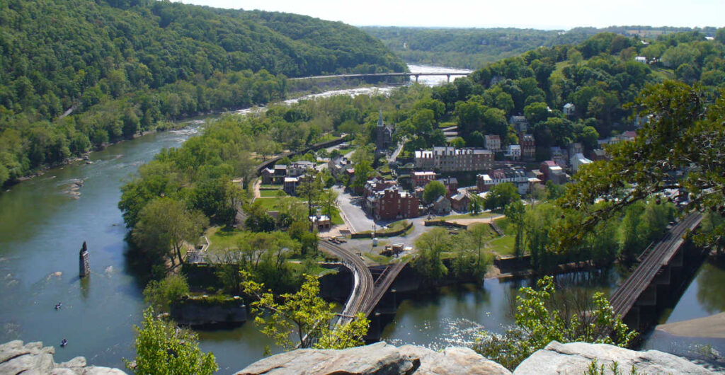
Maryland Heights is one of the most popular hikes in the area for good reason. The trail takes you to the historic site of Civil War fortifications. It features a steep climb leading to breathtaking views of Harpers Ferry and the confluence of the Potomac and Shenandoah Rivers. The trail is moderately challenging with some rocky sections. However, the view from the overlook is worth every step. If you only have time for one hike in the area, this is the iconic Harpers Ferry hike.
Weverton Cliffs

Mileage: 2.7 miles (round trip)
Parking: The trailhead is located on Weverton Road near Route 340. The small parking lot fills up quickly on some weekends. Overflow parking is available along the road.
Difficulty Level: Moderate
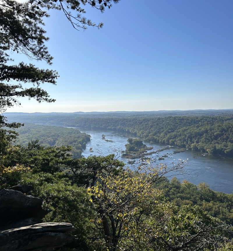
Weverton Cliffs offers a shorter uphill hike with a big payoff. The trail is part of the Appalachian Trail through Maryland. Switchbacks lead to a rocky outcrop with stunning views of the Potomac River and the surrounding valley. It’s a popular spot for sunrise and sunset hikes. Therefore, consider timing your visit for these magical moments.
Loudoun Heights
Mileage: 7.5 miles (loop)
Parking: The trailhead is located near the Harpers Ferry Visitor Center. Parking is available at the Visitor Center, and a shuttle service is provided to the trailhead. Alternatively, you can park in town and walk to the trailhead.
Difficulty Level: Strenuous
For those looking for a longer and more challenging hike, Loudoun Heights is an excellent choice. This trail offers a more secluded experience, taking you through dense forests and past several historical sites. The trail eventually reaches the ridge. There, you’ll be rewarded with panoramic views of Harpers Ferry, the Potomac, and the Shenandoah Rivers. The hike is strenuous, with steep ascents and rocky terrain, so be prepared for a workout.
Sweet Run State Park
Mileage: Varies (up to 9 miles of trails)
Parking: Sweet Run State Park has several parking areas, including a main lot near the park entrance. The parking areas are well-marked and provide easy access to the trailheads.
Difficulty Level: Easy to Moderate depending upon the route.
Sweet Run State Park is one of the newer additions to the area. This park boasts a network of trails that wind through rolling hills, forests, and streams. It offers a peaceful escape into nature. The trails range from easy to moderate. Therefore making it an excellent choice for families or those looking for a more leisurely hike. The park is still relatively undiscovered, so it’s a great place to enjoy some solitude.
C & O Canal
Mileage:Varies (Towpath stretches for 184.5 miles; customize your hike)
Parking: Numerous parking areas are available across from and along the C & O Canal. There are spots in Harpers Ferry, Brunswick, and along the canal in Maryland. Parking availability can vary, so it’s wise to plan ahead. Also, parking is available in Harpers Ferry National Historical Park. You can walk across the footbridge to access the C & O Canal.
Difficulty Level: Easy
The C & O Canal Towpath is an historic trail that runs parallel to the Potomac River. It offers a flat and scenic route perfect for hiking, biking, or a leisurely walk. The section near Harpers Ferry is particularly beautiful, with views of the river, cliffs, and lush greenery. You can customize your hike by choosing a starting point and distance that suits your needs. The towpath is ideal for those who prefer a gentler hike minus the steep climbs of the area’s other trails.
Harpers Ferry offers a diverse array of hiking options for best hikes in the Harpers Ferry, WV area. Each provides a unique perspective on the area’s natural beauty and historical significance. Whether you’re scaling the heights of Maryland Heights or enjoying a tranquil walk along the C & O Canal, there’s something here for every hiker. Make sure to check parking availability, arrive early, and bring plenty of water. This will ensure a safe and enjoyable experience on the trails.
